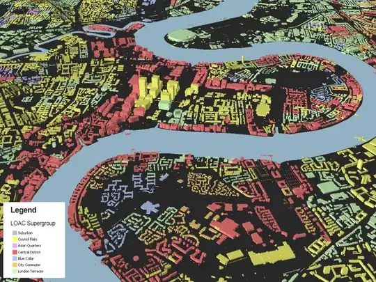
An few interesting applications can be found on James Chesire's blog in this post, Deceptive in their Beauty?. In that particular example he gives both positive comments about using building parcel data to attempt to more accurately visualize population location data (mainly referring to the work on dasymetric mapping versus just symbolizing census geographies), but also gives some critical comments. In particular, the mapping of the population attributes to the building parcels implies a much greater level of precision in the data than it warrants (a sentiment that fits in well with Kirk's comment about an uncertainty principle). It is a similar critique to many dot density maps (which the blog mentions as well).
He has a few other examples, and points to the work of Charles Booth. A relevant historical figure in mapping such small units. An example of his work (original link available from blog post) is below.