I'd like to get involved with GIS, im a marine engineer and clueless about it and although i've tried to research it, I'm overwhelmed by the amount of programs available & information. I wanted to do a personal project, what i have in mind is try to map the flow of Natural Gas.
So how should i go about it to complete my project?
I need a free program to start; which one would you suggest?
Does it have forums / documentation support?
I'm alone on this, so the easier I can get info/answers the better. I'd rather get a local program ie. not web based. I run windows7.
As I understand it, I also need:
- A world map with countries?
- Some import/export data which I think I've found.
- What else would I need to do the analysis from the program pov?
- Some analysis tool to get the flows? Is that included in the program or must I find an add-on or something like this?
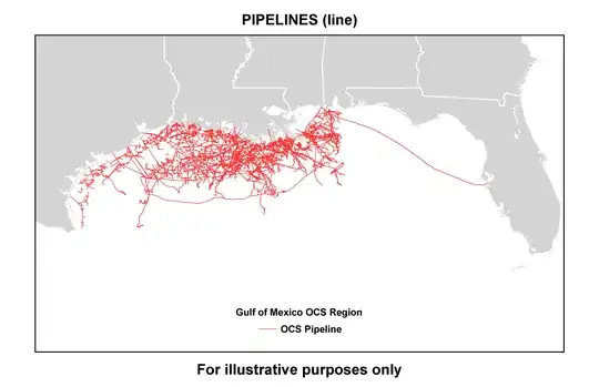
My future targets include finding/plotting sea routes & also pipelines. Would the suggested program be capable of doing that? Would it automatically be able to plot the sea routes?
Sorry if I wasn't clear but what I'm asking is what free GIS program can do all of the above?
Is there a step by step guide to learn?
As suggested from the posts QGIS is a starting point & read its manual with a goal to do networks analysis. ArcGIS is the industry standard and when I have enough money I should consider it. Getting a book as well would help. Long-term doing python programming or something.