2 days searching and looking for a guideline to enable GDAL extension for GeoServer, I found many questions here and I followed all steps, but unfortunately the problem still exist the default raster extension not changed.
I just need a clear guideline how to enable GDAL, ECW, MrSID extensions for GeoServer 2.15.0
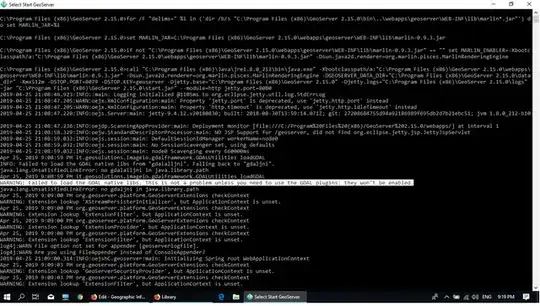
edit: error message
WARNING: Failed to load the GDAL native libs. This is not a problem unless you need to use the GDAL plugins: they won't be enabled.