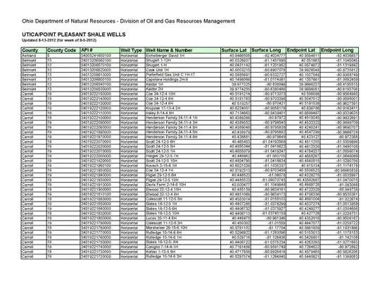
How do I convert (the attached image) from long/lats from my spreadsheet to drop into my shapefile for the Well locations?
I have ArcMap (Editor/Standard) 10.0. I never had to do this conversion before. The lats/long is located Eastern Ohio. I know I have to do something with X/Y but I am new to this conversion.