I'm in the process of creating a webpage to ease the process of visualizing NOTAM navigation warnings. Never done any geospatial software development before, so all the terms like geoid, reference ellipsoid, datums, different coordinate systems are new to me, though I've been doing a lot of reading up on the related material. I'm using the DotSpatial.Projections library to load the projection info either based on the EPSG code or the corresponding proj4 string. The target coordinate system is the one used by Google Maps API - (WGS84 / EPSG 3857).
I'm having trouble figuring out the proper conversion source coordinate system/projection. What I've come up with does not give the proper results: https://epsg.io/transform#s_srs=42310&t_srs=4326
The source coordinate system is described here: http://eaip.eans.ee/2018-02-01/html/eAIP/EE-GEN-2.1-en-GB.html#GEN-2.1-Geodetic
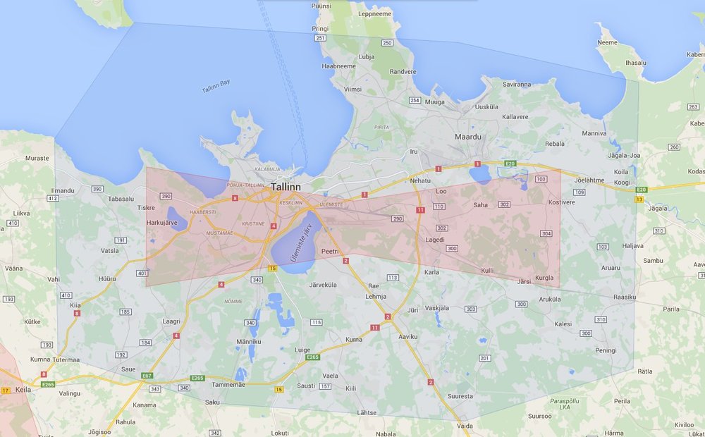
The converted nor the original coordinates don't align with the expected result. For example, the Zone 9 near north of Estonia surrounding Tallinn: Expected result, actual result on my website (large red/green polygon south of Tallinn)
Some proj4 strings I've come up with: NOTAM:
+proj=lcc +lon_0=24.0 +lat_0=57.51755393 +lat_1=58.0 +lat_2=59.3333333 +ellps=GRS80 +datum=WGS84 +units=degrees +no_defs
Google Maps:
+proj=longlat +ellps=WGS84 +datum=WGS84 +no_defs
The aforementioned two strings result in a very tiny projection near the reference point of the source coordinate system.
This application is initially for personal use as a drone pilot to visualize if there are any flight restriction zones active at a given time.
593002N 0243035E 593227N 0243351E 593142N 0245804E 593012N 0251134E 591918N 0251110E 591718N 0245834E 591800N 0243934E 591908N 0243231E 592154N 0243044E 593002N 0243035EReference Google maps (correct output):
– Mihkel Apr 08 '18 at 19:01593649N 0245122E 593188N 0245419E 592999N 0246594E 592883N 0249761E 593216N 0251861E 595033N 0251927E 595283N 0249677E 595408N 0245641E 595005N 0245097E 593649N 0245122E