5

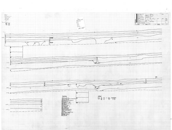
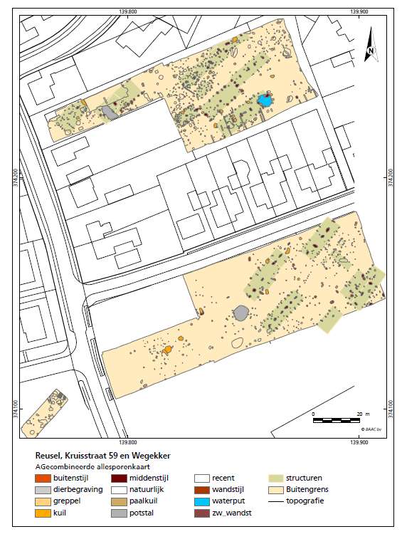
I'm trying to figure out a way to draw archeological sections in QGIS (example). We currently only draw the layers and features digitally (like this). When we make a section of features or a profile we draw a line from point a to b with the gps and make an analog drawing of the actual section or profile.

The idea is to draw section in the field on a rugged tablet within QGIS and link them to a section line (point a to b).

How do I set this up?

Val P
  • 3,858
  • 1
  • 8
  • 33
Arjan
  • 71
  • 2
  • So you're just looking to take data you already have and create cross sectional profiles from it? What have you tried so far? – jcarlson Feb 21 '18 at 12:00
  • Sorry it took a while for me to respond, i was in the field. What i've seen another company do is plot a millimeter grid in qgis and draw a profile on that. Later they would link it to the a-b line measured with the gps so you'd have a spatial link. I'm fairly inexperienced in Qgis and i'm learning by figuring stuff out myself but i can't find info on how to approach this problem. – Arjan Feb 23 '18 at 09:56
  • Take a look at this question. Does it help you any? If you have known elevation values for the a-b line or a reasonably hi-res DEM of the area, you can create the profile line digitally within QGIS, instead of drawing by hand. – jcarlson Feb 25 '18 at 01:06
  • profileAAR Plugin? https://plugins.qgis.org/plugins/profileAAR/ – Mapperz Mar 05 '20 at 22:15

0 Answers0