Aster DEMs are in EPSG 4326 (lat lon WGS84). According to the GDAL DEM documentation:
For LatLong projections near the equator, where units of latitude and units of
longitude are similar, elevation (z) units can be converted to be compatible
by using scale = 370400 (if elevation is in feet) or scale = 111120 (if
elevation is in meters). For locations not near the equator, it would be best
to reproject your grid using gdalwarp before using gdaldem.
In this answer for a problem with hillshading (Scale and Z factor have no effect on hillshade analysis in QGIS) user @Luke provides a way to calculate the correct scale ("ratio of vertical to horizontal units") by multiplying the cosine of the latitude times 111320. The scale affects slope calculations.
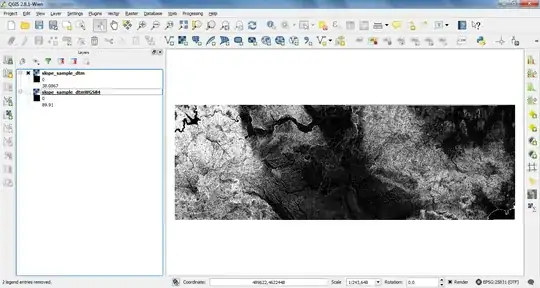
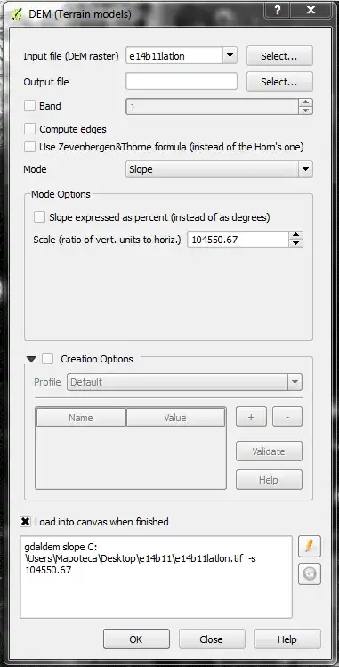
In the image below I was able to produce slopes in degrees from a DEM in EPSG 4326 at latitudes ranging from 19°45N and 20°N. The scale (-s) was set to 104550.67.
If you want to work with a DEM in a CRS that defines the measuring units of the coordinates and the elevations in meters you must reproject the DEM using raster/projections/warp (reproject). For example, reprojecting from EPSG 4326 (lat lon wgs84) to EPSG 32164 (UTM WGS84 14N). See below:

In this case, when calculating slope, the "ratio of vertical to horizontal units" (scale) would be set to 1.