I am still beginner in Remote Sensing.
I have asked a GRASS programmer to prepare for me Landsat reflectance values from raw DN values (1 scene per year from 1987 to 2013). I have proposed him (following litterature and p.ex. Is there a way to automate the preprocessing of LANDSAT data?) to run step by step next tools to obtain reflectance values:
- i.landsat.toar (addon for GRASS 6, included in GRASS 7) - convert DN to top of atmosphere radiance
- i.atcorr - correct top of atmosphere to surface reflectance
These surface reflectance values were subsequently corrected by topographic normalisation DOS3 by i.topo.corr because of my mountainous AOI.
How is it possible to establish/check if calculated reflectance values are right?
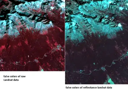
The reason why I am asking is because if the reflectance values (right) are more appropriate for vegetation study.
Why do the raw Landsat data (left) values sees to be better visually distinctive ?
Is it only a question of appearance?