10

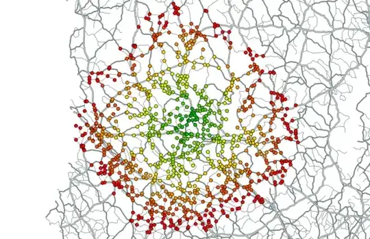
Just installed QGIS as I believe I should be able to produce walking and cycling isochrones from a specified point. I have done this pretty easily before using ArcMap, however, I am really struggling with QGIS.

From what I have read, I should be using PGRouting and OSM2PGrouting mapping (which I have installed). I haven't really used SQL before and seek a dummies guide to doing these isochrones. I have read about various ways, most detailing SQL which I am struggling with.

PolyGeo
  • 65,136
  • 29
  • 109
  • 338
Becky H
  • 101
  • 1
  • 4
  • http://anitagraser.com/2011/02/12/drive-time-isochrones/ will help get you started – Mapperz Jan 07 '15 at 15:04
  • 1
    There are many possible approaches. Pick one and then describe which step you are having trouble with. You will get much more focused answers than by asking for a step-by-step guide for the whole process. – underdark Jan 07 '15 at 17:32

1 Answers1

5

There are a couple of sources which describe how to develop isochrone maps:

  • Public transport isochrones with pgRouting

    This post contains information in great detail on how to install, run and conduct a variety of analyses on isochrone maps with pgRouting. Included a couple of images so you can if it's something you are looking for:

pgRouting driving_distance

Image of pgRouting driving distance.

Creating Catchment Areas with pgRouting

Image of Catchment Areas with pgRouting.

Joseph
  • 75,746
  • 7
  • 171
  • 282