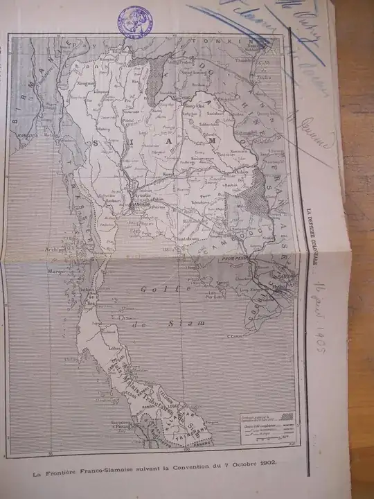
I'm trying to georeference this part of an old map of Indochina.
 .
.
The full extent gives more information:
 .
.
To do so, I used QGIS and tried to infere the datum, I tried "Unknown datum based on Everest", but it gave me a big difference that you can see in this screenshot:
 .
.
I did it with the three geodesic intersections available in the map. To understand the problem, I looked at Luang Prabang (the city close to the intersection of geodesics on the top of the map) coordinates and found 19.53 N and 102.80 W on geonames.org. On my map, it is more about 100 W, that is a big difference.
Thus my questions:
- given that it is an old map, does the inaccuracy result from the mappers who did the map (hats off for there impressive work btw !) or is it that I do not have the right method (datum, choice of points, ...) ?
- how can I georeference this map ? (My goal is to digitize the borders).

